The Observing Earth From Space (OEFS) class has once again wrapped up another impressive Spring semester. Each year, as part of the course’s tradition, students showcase their mastery of remote sensing analysis techniques by delivering final projects, applying the skills they’ve accumulated over the semester.
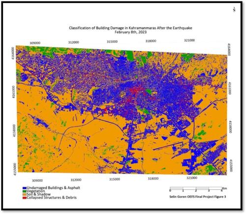
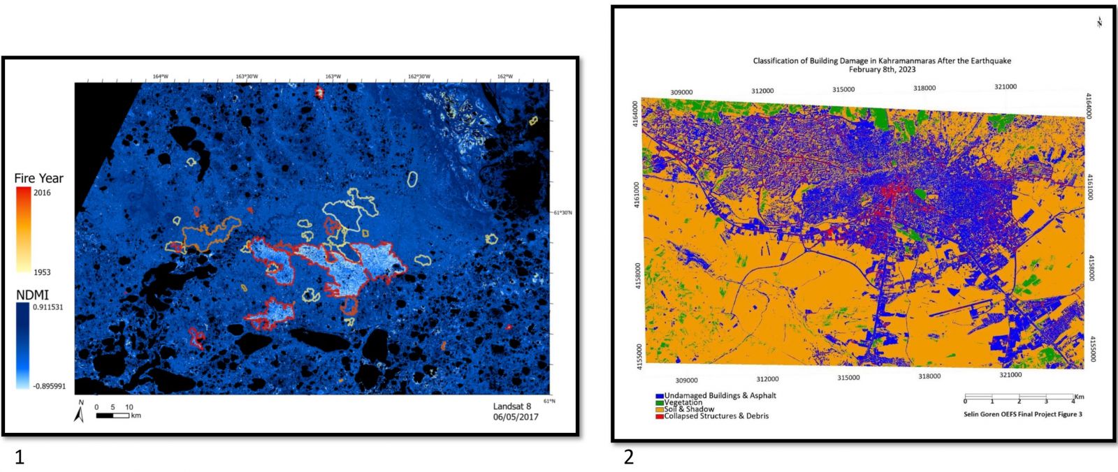
These projects aren’t just theoretical exercises. Some students incorporated their work into their thesis or dissertation, underlining the practical importance of the OEFS course. The diversity of this year’s projects encompassed a broad range of environmental issues. For instance, one student tracked the recovery of the Tundra following a wildfire. In another project, high-resolution satellite images were employed to quantify the damage caused by the disastrous earthquake that struck Kahramanmaraş in Turkey earlier this year.
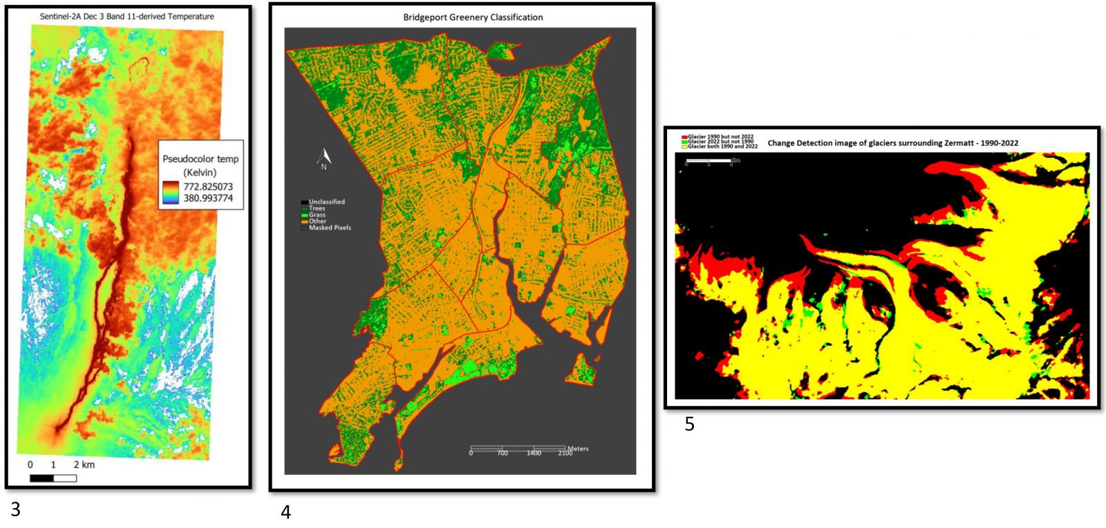
One student utilized high-resolution imagery to perform quantitative analysis of lava flows, paving the road for using high-resolution satellite imagery for a future quantitative analyses of lava flows such as temperature determination and creating a dual-component model for the flow. Urban greenness was also a point of focus, with a student using NDVI data from satellite images to examine greenery levels in the thirteen neighborhoods of Bridgeport, Connecticut, correlating these with neighborhood income levels using spatial statistics. Further, the alarming reality of glacier melt was highlighted in a project that investigated glacier retreat in Zermatt, Switzerland from 1990 to 2022.
For a complete list of projects and topics covered by the students for OEFS Spring 2023, please follow this link.
The above images highlight the following projects: