Training in Geospatial Analysis of Disease Vectors
The workshop “Training in Geospatial Analysis of Disease Vectors” was held from June 1, 2015 to June 5, 2015 at the Biotechnology Research Institute (BRI) in Muguga, Kenya. This effort was part of an NIH – Fogarty Institute training grant (PI Aksoy, Caccone, Murilla) designed to strengthen capacity in biomedical research, including geospatial analysis of disease vectors. BRI has a mandate to carry out research and develop technologies for effective control of tsetse and trypanosomiasis in the country and this workshop introduced several technologies that can be applied to these issues.
The goal of the workshop was to introduce participants to Geographic Information Systems (GIS), satellite-based remote sensing, and ecological modeling. Students used the provided suite of open-source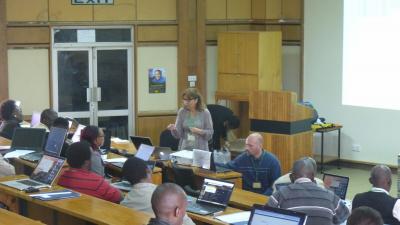 software to manipulate GIS data and satellite images to create basic species habitat models. There was a special focus on identifying and mapping tsetse fly habitat. The full workshop schedule can be viewed here.
The Yale Institute of Biospheric Studies was instrumental in making this happen, with members of two Centers and one Program organizing and teaching this workshop. Gisella Caccone, Director of the Molecular Systematics and Conservation Genetics Center, organized the workshop, gave foundational lectures on trypanosomiasis and tsetse flies, and provided support and encouragement to the other instructors.
 Larry Bonneau of the Center for Earth Observation provided an introduction to geospatial data and software. This included lectures and exercises on GIS, remote sensing and GPS.
Giuseppe Amatulli of the Program in Spatial Biodiversity Science & Conservation provided a custom suite of open source geospatial software tools that made the workshop possible. His lectures and exercises covered the Linux operating system, GDAL and PKTools, the statistical analysis package “R”, and various spatial modeling techniques.

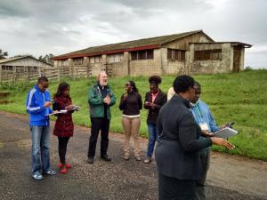
Over 70 students and researchers from central and eastern Africa applied for this workshop. After careful consideration of each applicant we selected 25 candidates that we felt would benefit the most from the workshop. After working with the attendees for a week and witnessing the effort they made to learn a great deal of complicated information, we all agreed that we had a great class!
At the end of the week 84% of the attendees stated that the workshop exceeded their expectations and 88% believed the workshop was extremely useful. Everyone agreed that learning these open source tools would help them in their current and future research and jobs. You can view the complete post-workshop questionnaire here.
Below are some of the final student comments:
“Thank you for the opportunity you gave me to participate in this training. … and please organize more courses!”
“The knowledge gained from this training will be very helpful to my data analysis in mapping disease incidence against different geographical locations in Madagascar”
“The course is a must need for all students interested in research. All vector control operatives in Uganda need this training.”
“This was a very important training since it enabled us to get training in species distribution modeling - a course that is not available locally in Kenya.”
“The course has helped me to understand well the open source Geospatial tools and how to apply them in vector ecology and biology. It’s the best course that I have attended”
“…It was an awesome and very informative workshop, and I cannot wait to start utilizing the Geospatial analysis skills learnt in my work and future work.”
“It was a wonderful and awesome workshop. Magic!!! The knowledge gained will be useful for my field work during my data collection and also for my future work.”

All agree it was a very successful workshop. The students worked hard and learned a great deal that should help them in their future research. The collaboration amongst the YIBS Centers and Program provided a skill set and synergy that made this possible.
An alternative view of this workshop summary is available on the Spatial Ecology website.